WeatherSatelliteMap
8.0 by YI HAN TSAI (0 Reviews) January 30, 2024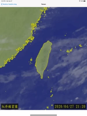
Latest Version
Version
8.0
8.0
Update
January 30, 2024
January 30, 2024
Developer
YI HAN TSAI
YI HAN TSAI
Categories
Weather
Weather
Platforms
iOS
iOS
File Size
8.7 MB
8.7 MB
Downloads
0
0
License
Free
Free
Report
Report a Problem
Report a Problem
More About WeatherSatelliteMap
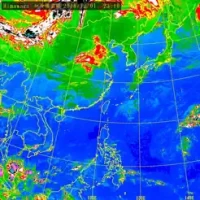
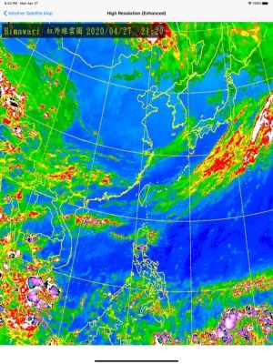
This app is an app that lets you browse satellite clouds images.
This data of this app is taken from the opendata platform of Central Weather Bureau of Taiwan (http://opendata.cwb.gov.tw/index). This app only displays the function not storing pictures.
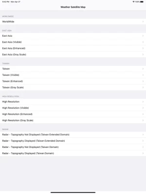
Currently, users can view the following images which is provided by the weather bureau of Taiwan.
WorldWide, Infrared Black and White- Global, Infrared Color Intensification- Global, Visible- Global, Full Resolution Infrared Black and White- Golbal, East Asia, Taiwan, True color Image, Taiwan (Visible), Taiwan (Enhanced), Taiwan (Gray Scale), High Resolution (Visible), High Resolution (Enhanced), High Resolution (Gray Scale), Radar (Topography Not Displayed (Taiwan Extended Domain)), Radar (Topography Displayed (Taiwan Extended Domain)), Radar (Topography Not Displayed (Taiwan Domain)), Radar (Topography Displayed (Taiwan Domain))
Rate the App
Add Comment & Review
User Reviews
Based on 0 reviews
No reviews added yet.
Comments will not be approved to be posted if they are SPAM, abusive, off-topic, use profanity, contain a personal attack, or promote hate of any kind.