
Pilot Charts
1.0.1 by Prevailing Weather Conditions. (0 Reviews) February 10, 2024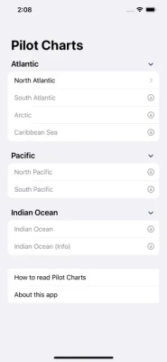
Latest Version
Version
1.0.1
1.0.1
Update
February 10, 2024
February 10, 2024
Developer
Prevailing Weather Conditions.
Prevailing Weather Conditions.
Categories
Weather
Weather
Platforms
iOS
iOS
File Size
56.2 MB
56.2 MB
Downloads
0
0
License
$5.99
$5.99
Report
Report a Problem
Report a Problem
More About Pilot Charts
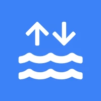
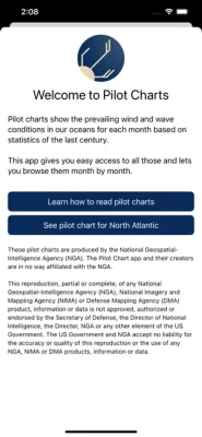
Pilot charts show the prevailing wind and wave conditions in our oceans for each month based on statistics of the last century.
This app gives you easy access to all those and lets you browse them month by month.
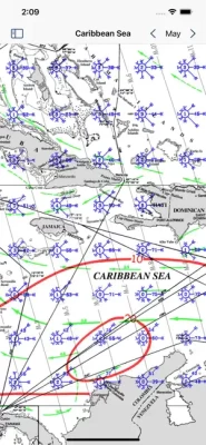
The charts are provided by the National Geospatial-Intelligence Agency and cover:
- Atlantic
- Pacific
- Indian Ocean
- Caribbean Sea
The app comes preloaded with the chart for the North Atlantic. Additional charts can be downloaded free of charge.
The charts are provided by the National Geospatial-Intelligence Agency and cover:
- Atlantic
- Pacific
- Indian Ocean
- Caribbean Sea
The app comes preloaded with the chart for the North Atlantic. Additional charts can be downloaded free of charge.
Rate the App
Add Comment & Review
User Reviews
Based on 0 reviews
No reviews added yet.
Comments will not be approved to be posted if they are SPAM, abusive, off-topic, use profanity, contain a personal attack, or promote hate of any kind.