

ATAK Plugin: TAKSat
1.1.12 [5.2.0] by TAK Product Center (0 Reviews) October 01, 2024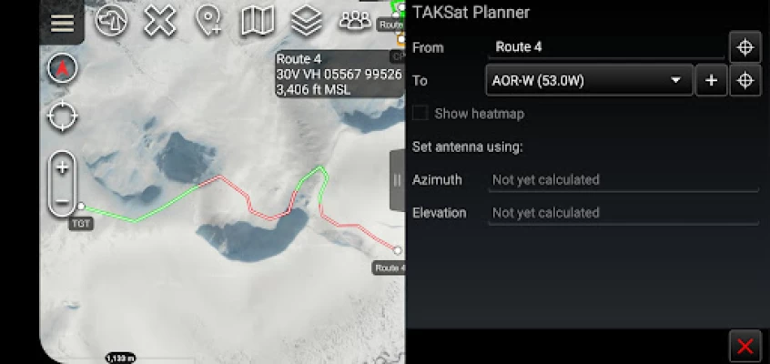
Latest Version
Version
1.1.12 [5.2.0]
1.1.12 [5.2.0]
Update
October 01, 2024
October 01, 2024
Developer
TAK Product Center
TAK Product Center
Categories
Maps & GPS
Maps & GPS
Platforms
Android
Android
Downloads
0
0
License
Free
Free
Package Name
com.atakmap.android.gbr.taksatplanner.plugin
com.atakmap.android.gbr.taksatplanner.plugin
Report
Report a Problem
Report a Problem
More About ATAK Plugin: TAKSat
ATTENTION: This is an ATAK Plugin. To use this extended capability, the ATAK baseline must be installed. Download the ATAK baseline here: https://play.google.com/store/apps/details?id=com.atakmap.app.civ
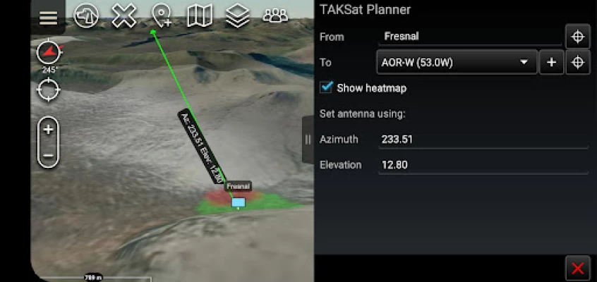
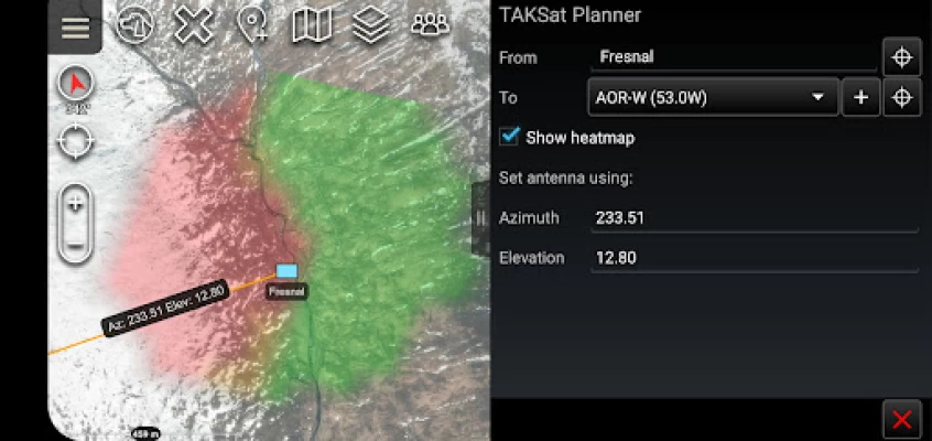
The TAKSat Planner tool calculates the Azimuth and Elevation required to achieve communication with a Geostationary satellite.
When available, it uses Digital Terrain Elevation Data (DTED) to determine terrain masking and whether communications are likely to be achieved. This can be from a fixed point or along a route. The tool can also generate a heatmap around a selected ground location to determine where in the local area communications are likely to be achievable from.
The plugin is pre-loaded with Immarsat BGAN satellites but users are able to quickly add other satellites.
A PDF manual for the plugin can be found at -> "Settings/Tool Preferences/Specific Tool Preferences/TAKSat Planner Preferences".
Best efforts are being made to keep the Open Beta Testing of this plugin updated to the same version as ATAK-CIV. Therefore if this plugin is outdated compared to your ATAK installation please consider signing up as a Beta Tester. Unfortunately, whilst feedback is appreciated, we can give no guarantees that requested features will be implemented.
Rate the App
Add Comment & Review
User Reviews
Based on 0 reviews
No reviews added yet.
Comments will not be approved to be posted if they are SPAM, abusive, off-topic, use profanity, contain a personal attack, or promote hate of any kind.