
Air Quality Index
1.0.1 by Smoke Prediction Maps (0 Reviews) January 09, 2024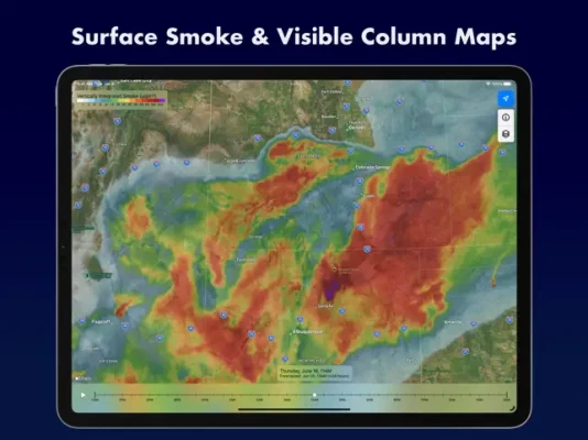
Latest Version
Version
1.0.1
1.0.1
Update
January 09, 2024
January 09, 2024
Developer
Smoke Prediction Maps
Smoke Prediction Maps
Categories
Weather
Weather
Platforms
iOS
iOS
File Size
3.7 MB
3.7 MB
Downloads
0
0
License
Free
Free
Report
Report a Problem
Report a Problem
More About Air Quality Index
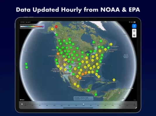
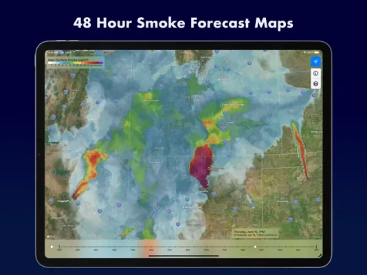
Air Quality Index displays 48 hour Near Surface and Vertically Integrated Smoke prediction maps using data provided by NOAA's National Centers for Environmental Prediction. Forecast maps are available for the Continental United States. The maps also optionally display AQI readings from the EPA's AirNow data service.
Rate the App
Add Comment & Review
User Reviews
Based on 0 reviews
No reviews added yet.
Comments will not be approved to be posted if they are SPAM, abusive, off-topic, use profanity, contain a personal attack, or promote hate of any kind.